 |
|
| Home | Town | History | People | Events |
| Media | Schools | Government | Links | Home |
| The Origin of the Town Name | The
Matewan Floodwall |
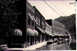
Local Merchants |
A
Brief Look at Matewan |
Shopping for Souvenirs |
| Business Opportunities | The
Visitors Center |
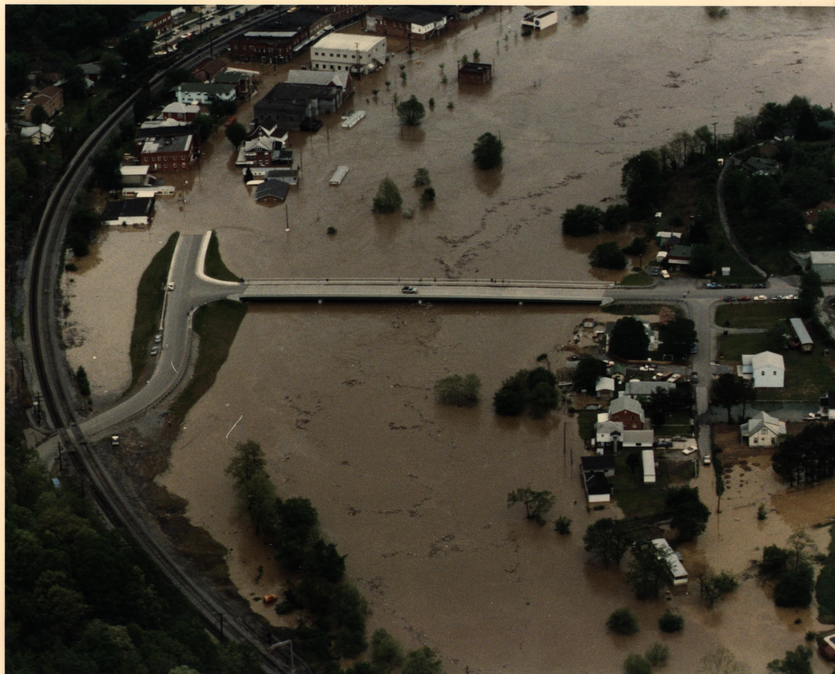
 The Matewan,
West Virginia, Fill/Floodwall Project was authorized by Section 202 of
the Energy and Water Development Act of Public Law 96-367 (October 1981)
and approved for construction by the Assistant Secretary of the Army (Civil
Works) in July 1982. The project has provided Standard Project Flood (SPF)
protection, plus freeboard to the Matewan Central Business District (CDB)
and April 1977 flood level of protection, plus freeboard, for the Mate
Creek area.
The Matewan,
West Virginia, Fill/Floodwall Project was authorized by Section 202 of
the Energy and Water Development Act of Public Law 96-367 (October 1981)
and approved for construction by the Assistant Secretary of the Army (Civil
Works) in July 1982. The project has provided Standard Project Flood (SPF)
protection, plus freeboard to the Matewan Central Business District (CDB)
and April 1977 flood level of protection, plus freeboard, for the Mate
Creek area.
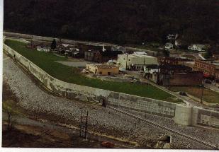
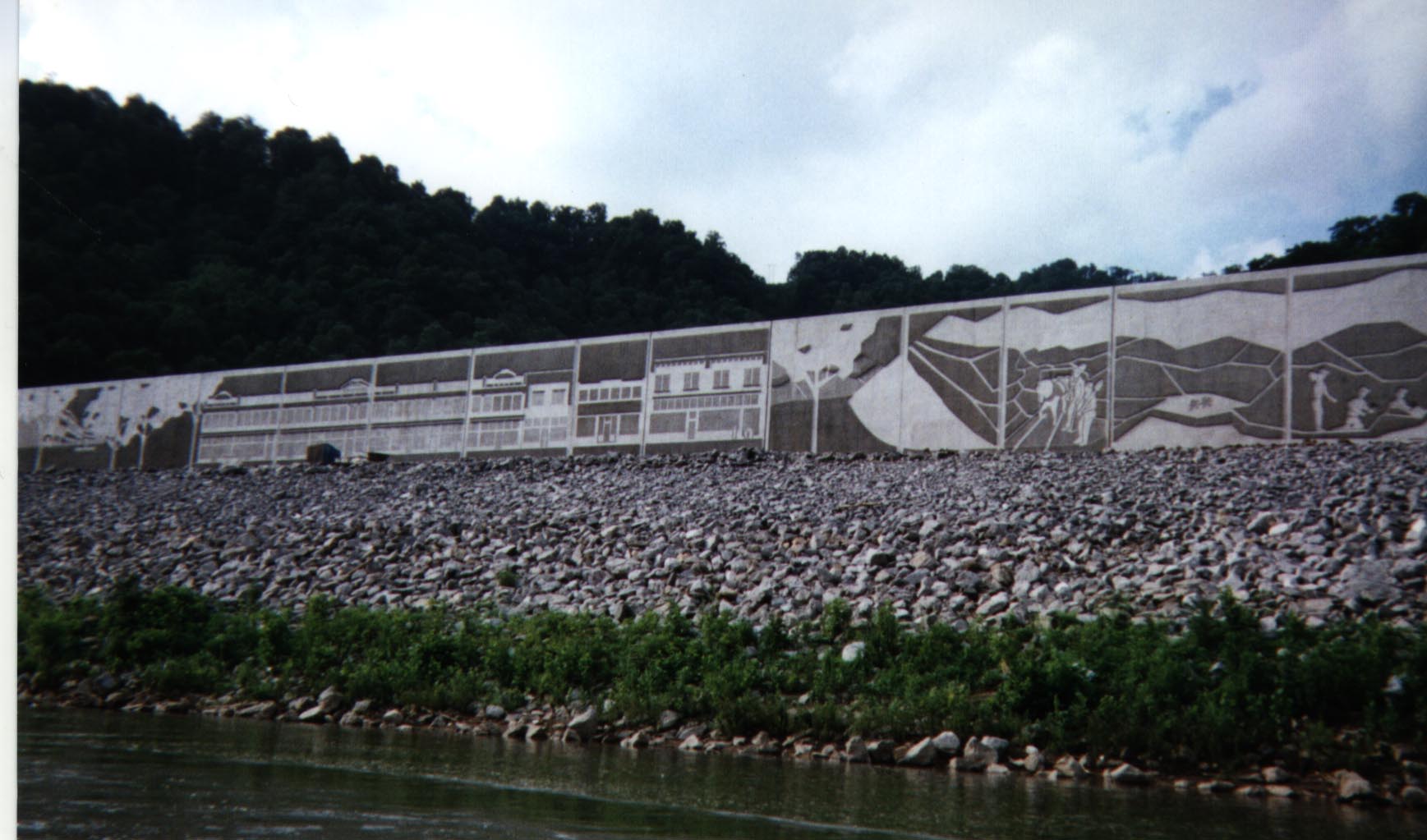
 Protection
of the Matewan CBD area consists of a 2,350 feet long floodwall, varying
in height between 6 and 29 feet above finished grade. The floodwall was
constructed upon a wide fill/levee structure designed to reduce the floodwall.
The floodwall surface is textured by vertical fluting and appropriate graphics
depicting the historical background of Matewan. In addition, a new storm
water interceptor system was constructed leading to an 18,000 GPM pump
station to handle a portion of the CBD interior storm water. The remaining
interior drainage, mostly from Warm Hollow, will be collected and disposed
by a large diameter diversion pipeline (pressure conduit). Also, the CBD
area includes seven gated closures, one pedestrian access door and Highway
49 bypass loop and the New Mate Creek bridge.
Protection
of the Matewan CBD area consists of a 2,350 feet long floodwall, varying
in height between 6 and 29 feet above finished grade. The floodwall was
constructed upon a wide fill/levee structure designed to reduce the floodwall.
The floodwall surface is textured by vertical fluting and appropriate graphics
depicting the historical background of Matewan. In addition, a new storm
water interceptor system was constructed leading to an 18,000 GPM pump
station to handle a portion of the CBD interior storm water. The remaining
interior drainage, mostly from Warm Hollow, will be collected and disposed
by a large diameter diversion pipeline (pressure conduit). Also, the CBD
area includes seven gated closures, one pedestrian access door and Highway
49 bypass loop and the New Mate Creek bridge.
Construction in Mate Creek consisted of an engineered fill structure raised to a minimum elevation of 709.0 and construction of new streets and utilities to support construction of new residential structures in the Mate Creek area (29 single-family units).
 In
addition to the basis flood protection works, a pedestrian walkway, on
the riverside of the floodwall, extends from the downstream end of the
CBD floodwall to the upstream extent of the Mate Creek fill structure.
This walkway allows access to the pedestrian door access in the CBD and
to two fisherman access platforms along the Tug Fork riverbank.
In
addition to the basis flood protection works, a pedestrian walkway, on
the riverside of the floodwall, extends from the downstream end of the
CBD floodwall to the upstream extent of the Mate Creek fill structure.
This walkway allows access to the pedestrian door access in the CBD and
to two fisherman access platforms along the Tug Fork riverbank.
Construction of the floodwall was begun in 1992 and was completed in 1997.
Adapted from the Matewan Action Plan
| Home | Town | History | People | Events |
| Media | Schools | Government | Links | Home |
Back to matewan.com
matewan@a-aautoparts.com